
Portfolio
Interactive Storytelling Maps
Maps are useful, often indispensable media for telling compelling stories within their geographic context.
I developed 3 storymaps using the following workflow and software stack:
- Workflow: an iterative collaboration between storyteller and developer to outline, design, and refine the storymap with compelling visuals and geography as the organizing framework.
- Software: Mapbox storytelling template and custom basemaps.
While working with Creative Associates, Project Managers elected to develop storymaps to explain the context and exhibit the impact from two outstanding international development projects implemented by Creative.
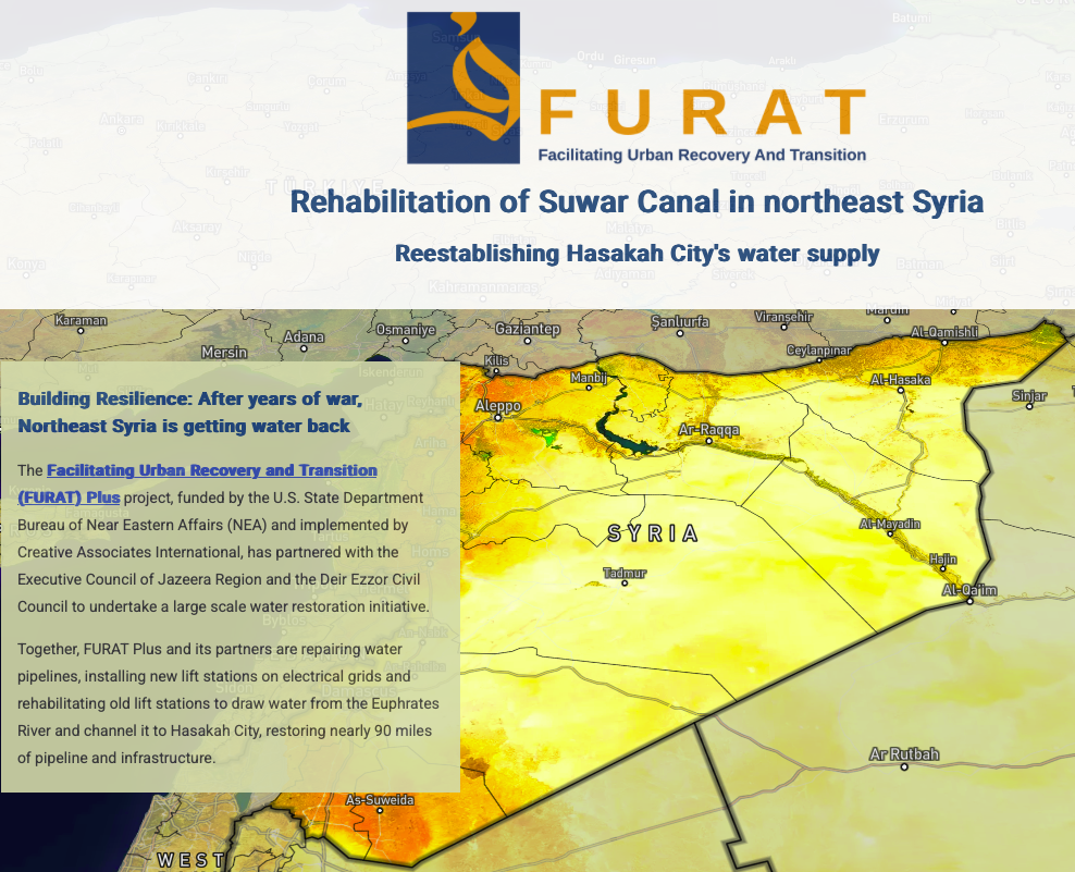
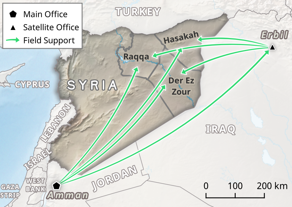
- Syria FURAT Water Project depicts the rehabilitation of water infrastructure in northeastern Syria in the aftermath of the country’s civil war.
- Honduras Dry Corridor Alliance Project portrays the resilience communities gained in the face of a changing climate through a child health and nutrition program.
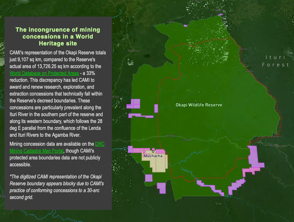
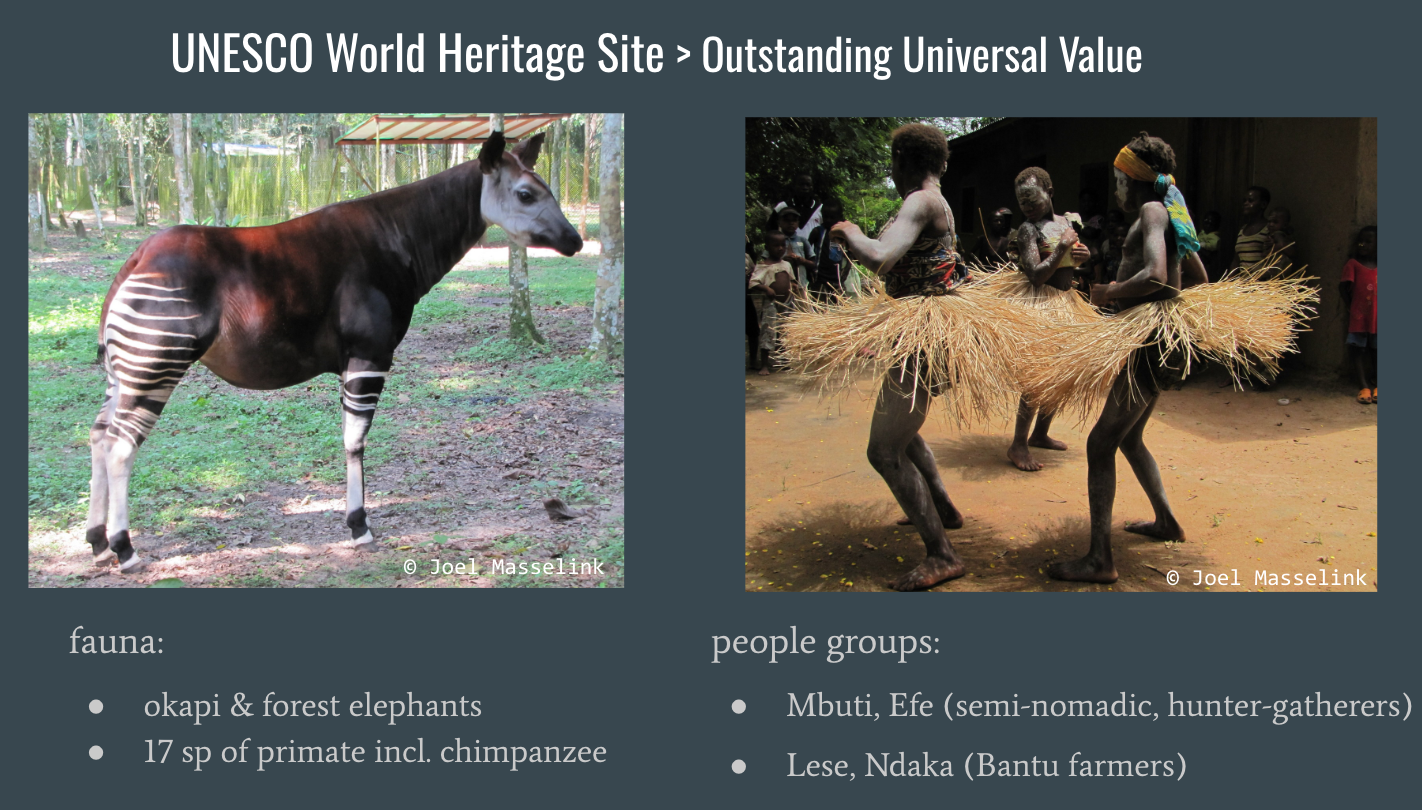
- Okapi Reserve – How A Mine Grows in a Forest is a personal project which explains how mining concessions have been awarded inside of a UNESCO World Heritage Site in the DRC, leading to widespread deforestation and environmental damage.
The above storymap (click on image above) integrates Sentinel-2 annual satellite imagery mosaics and visualizations of Global Forest Watch integrated deforestation alert data.
I re-engineered this from what had been Planet’s monthly imagery mosaics, a service which is no longer available as of 31 Mar 2025.
Cartography Portfolio
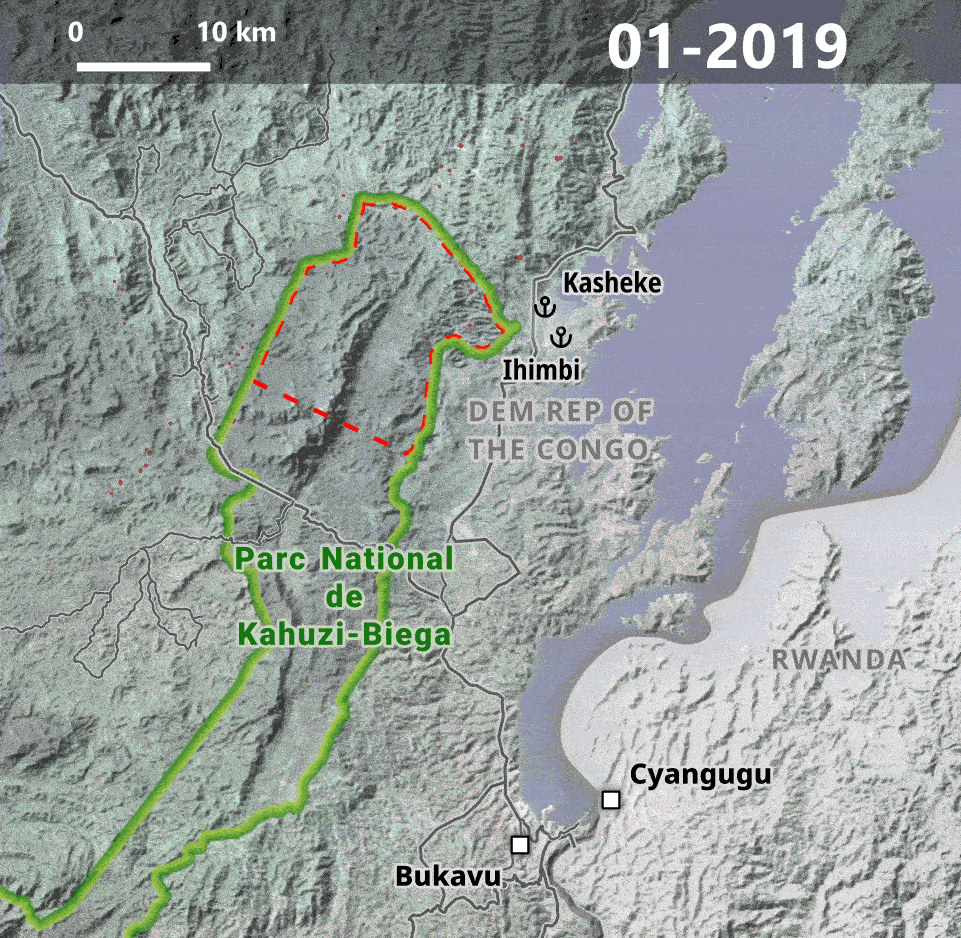
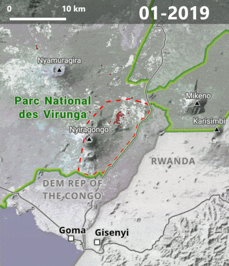
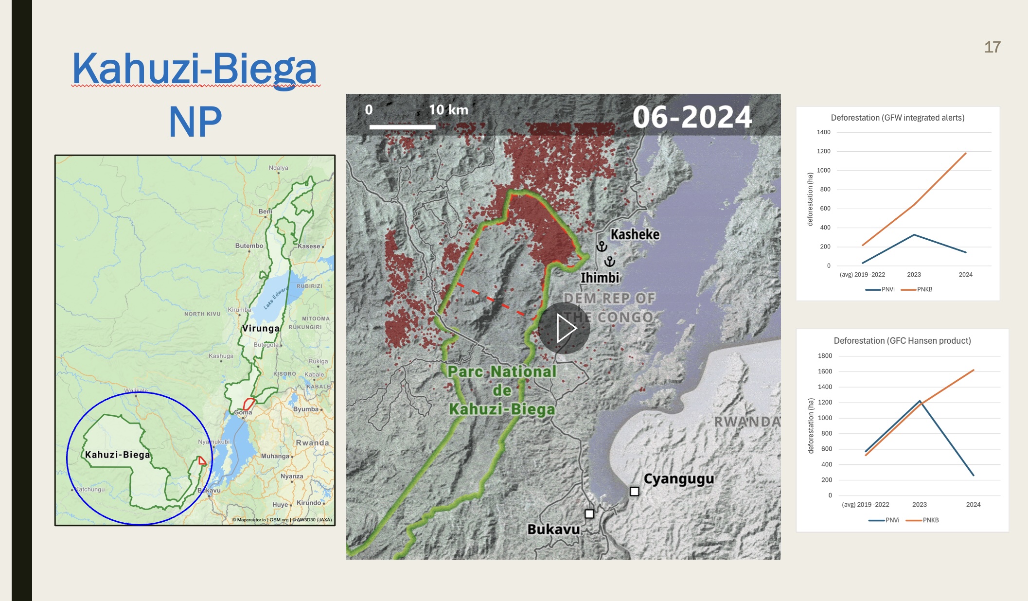
Building upon the Okapi Reserve storymap, collaborators at the University of Antwerp (Belgium) approached me for support in deforestation analysis of Virunga & Kahuzi-Biega National Parks. I developed a data processing workflow which converted Global Forest Watch integrated deforestation alerts into the following visualizations:
I calculated deforestation stats for the Mongabay article using the Global Forest Change product (Source: Hansen/UMD/Google/USGS/NASA).
Select Custom Maps
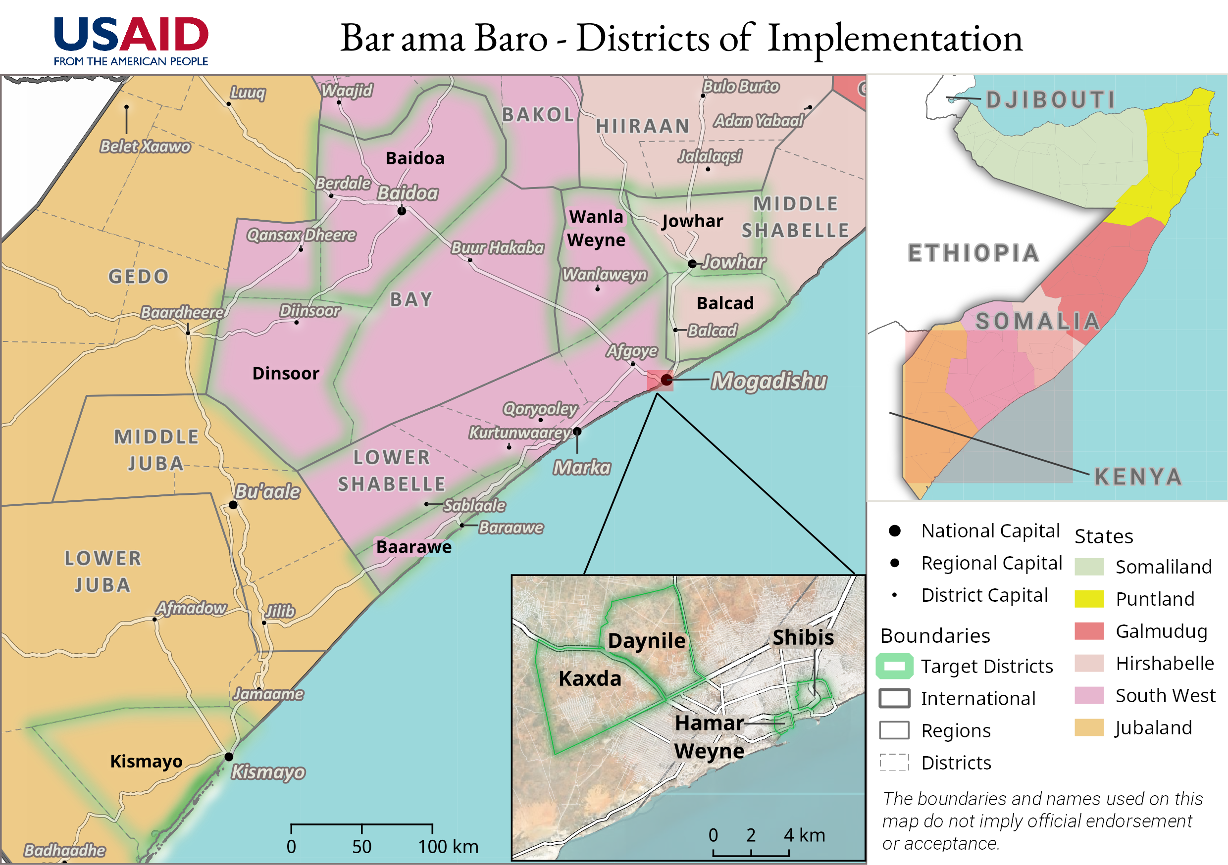
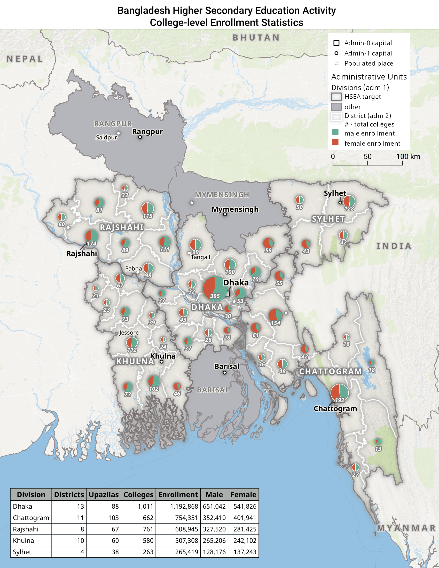
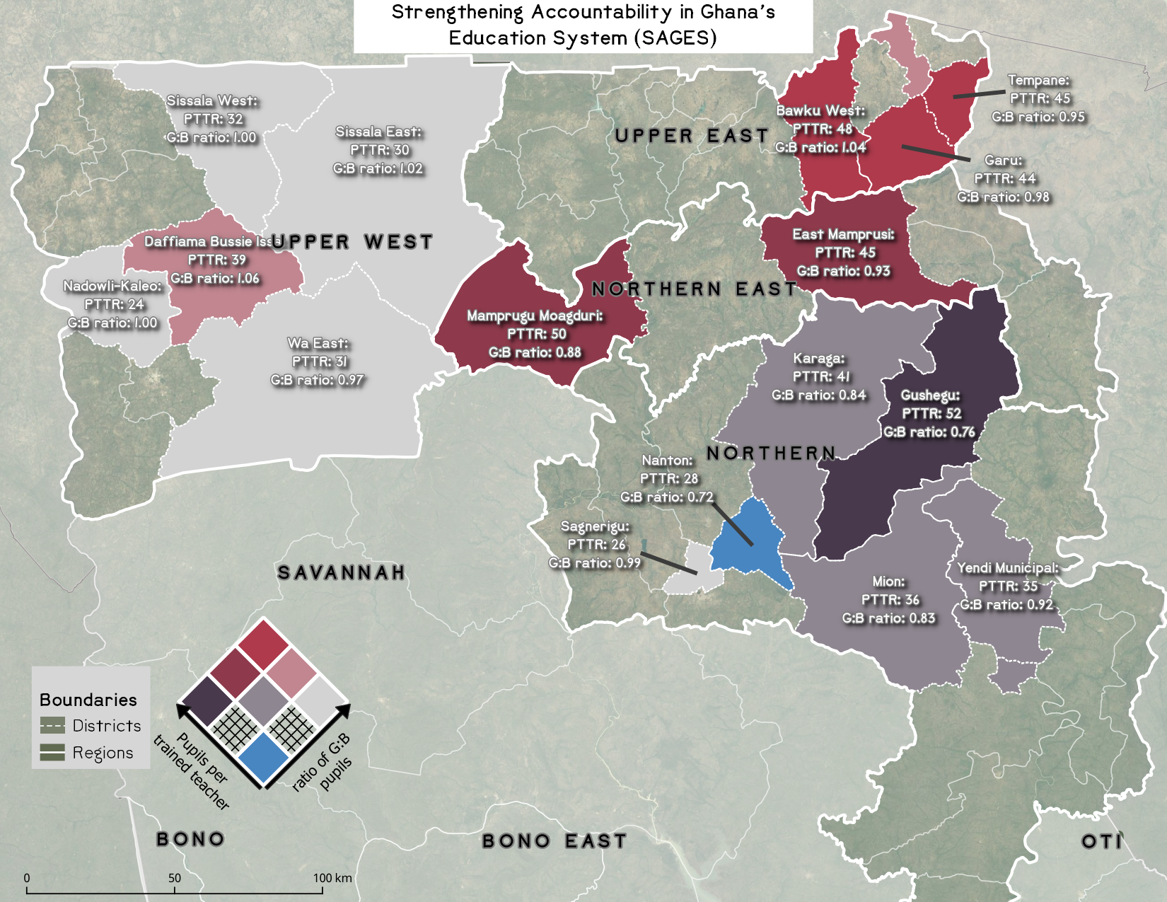
With Creative Associates, an international development contractor, I designed maps depicting project activities and areas of intervention, as well as maps to support business development.
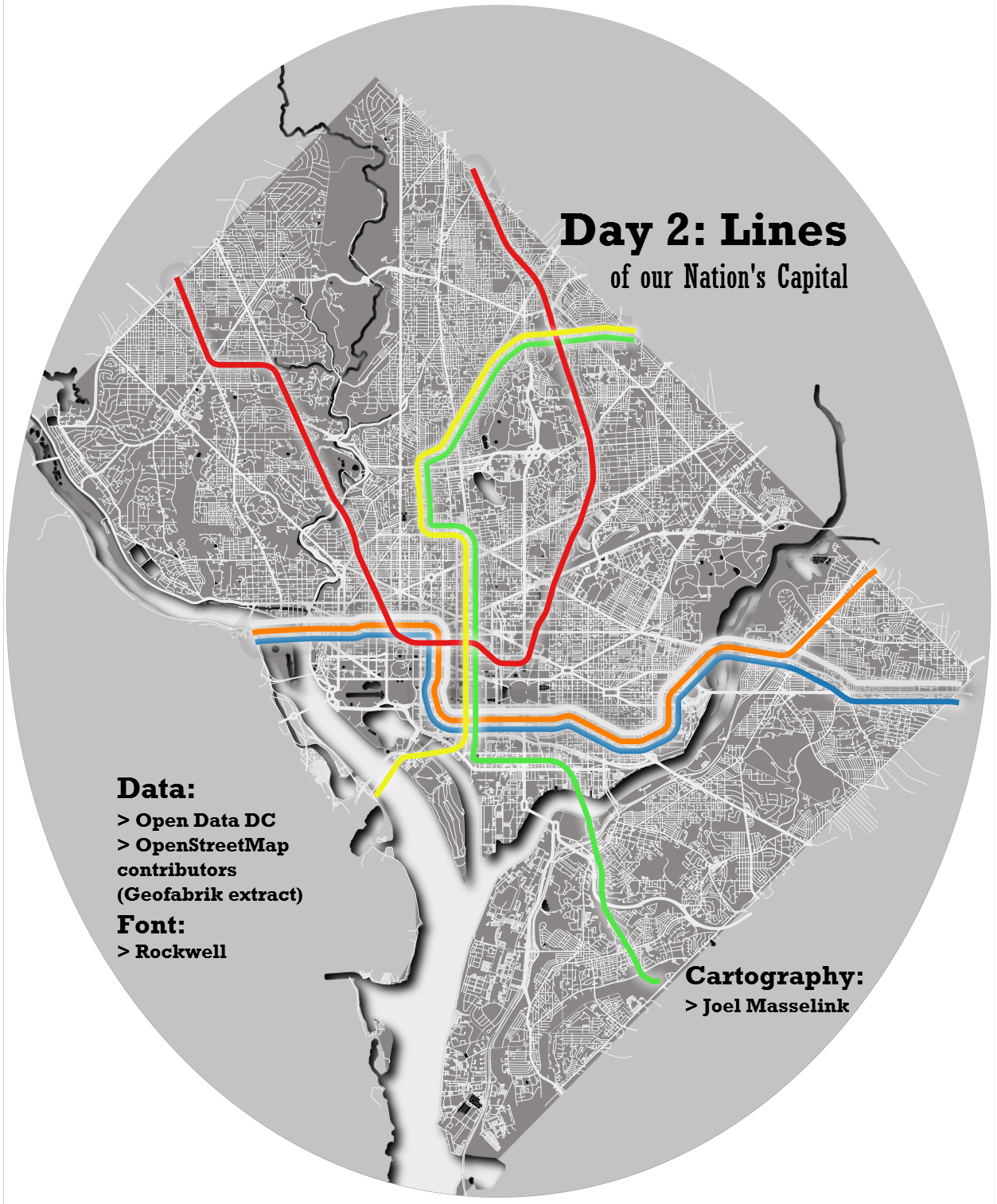
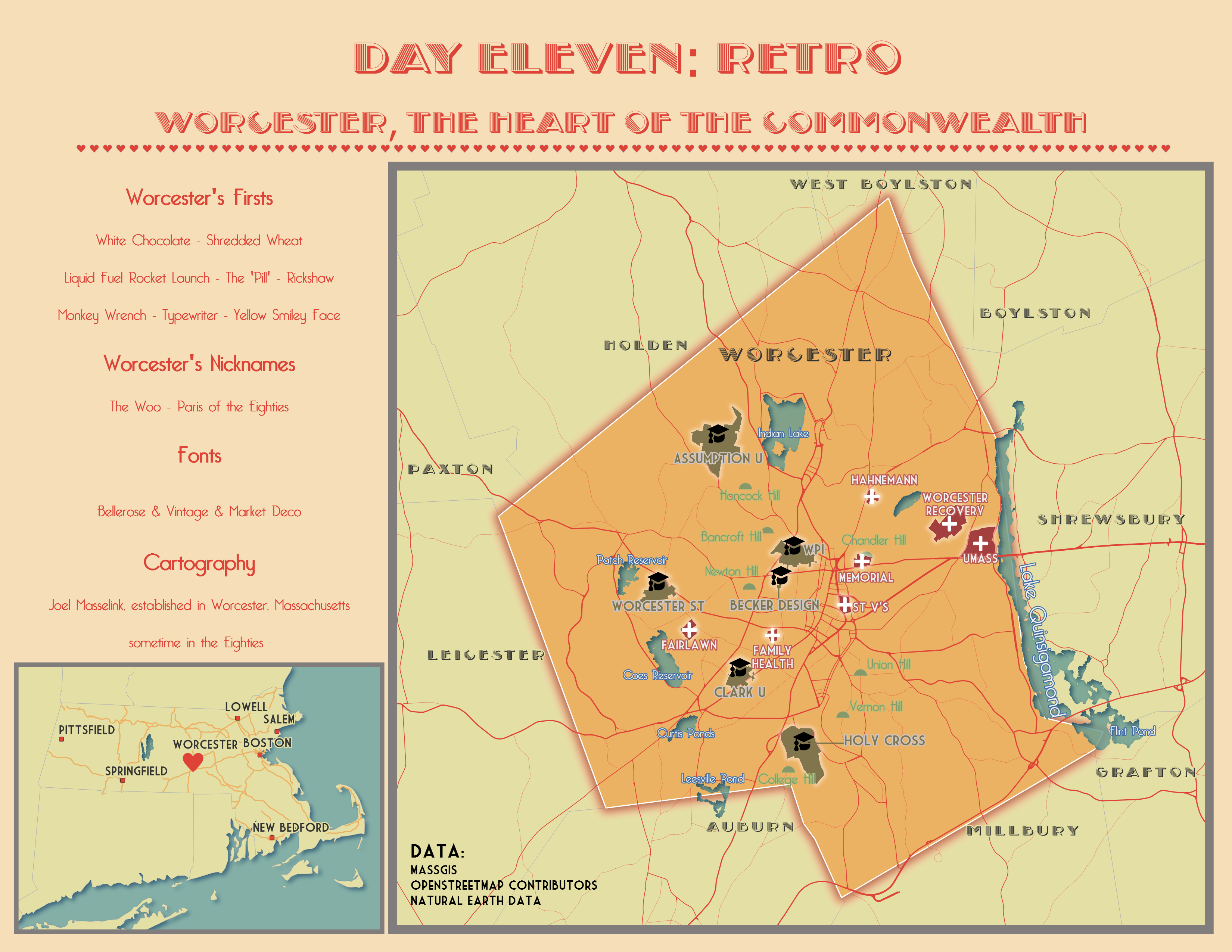
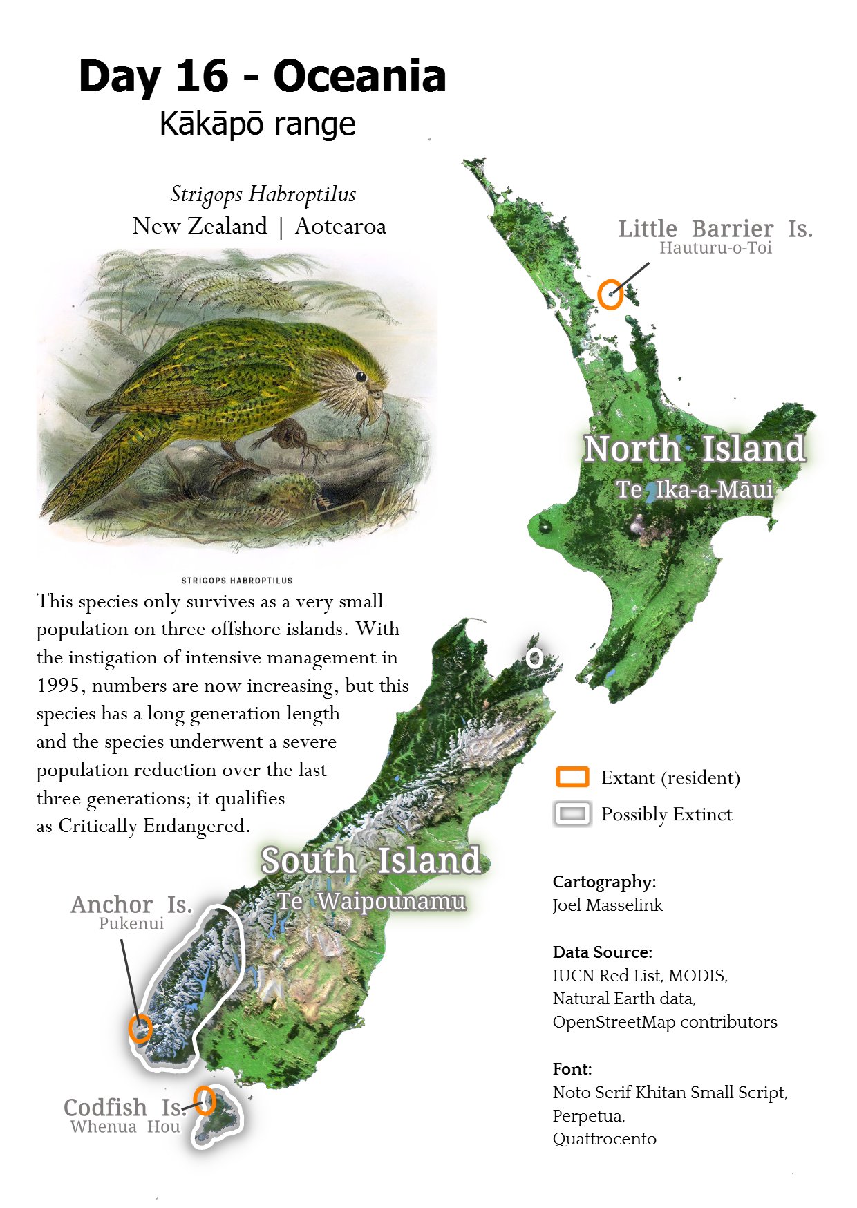
#30DayMapChallenge
In 2023, I participated in the 30 Day Map Challenge. Here are three of my favorite maps each of which were made using QGIS.
Select Presentations
2025 | Society for Conservation GIS International Conference
Analyzing Deforestation in Three DR Congo World Heritage Sites Using Global Forest Watch Alerts
2024 | Society for Conservation GIS International Conference
Mapped Reflections on a forested UNESCO World Heritage Site: Okapi Wildlife Reserve, Democratic Republic of the Congo
2023 | Society for Conservation GIS International Conference
The Rapid Growth of Semi-Industrial Mining in the Okapi Wildlife Reserve, Democratic Republic of the Congo
Conservation Planning Session recording (Vimeo)
Article Contributions
| OUTLET | ARTICLE | AUTHOR(S) | DATE | MY ROLE |
|---|---|---|---|---|
| Le Soir (in French) | L’environnement, victime oubliée de la crise M23 | Fergus Simpson, Lara Collart, Joel Masselink | 19 Mar 2025 | Author, contributor of map stats |
| Mongabay | The environmental toll of the M23 conflict in eastern DRC (Analysis) | Fergus Simpson, Lara Collart, Joel Masselink | 7 Mar 2025 | Author, contributor of map visuals & stats |
| The Associated Press | Chinese gold mining threatens a protected UN heritage site in Congo | Sam Mednick | 10 Dec 2024 | Quoted as a subject matter expert |
| Mongabay | ‘It’s a real mess’: Mining and deforestation threaten unparalleled DRC wildlife haven | Ruth Kamnitzer | 13 Oct 2023 | Source interview |